
How GeoDataVault Simplifies Global
Satellite Imagery Access
Search, task, manage, and access high-resolution satellite imagery and Earth observation intelligence through a fast, enterprise-grade geospatial platform.
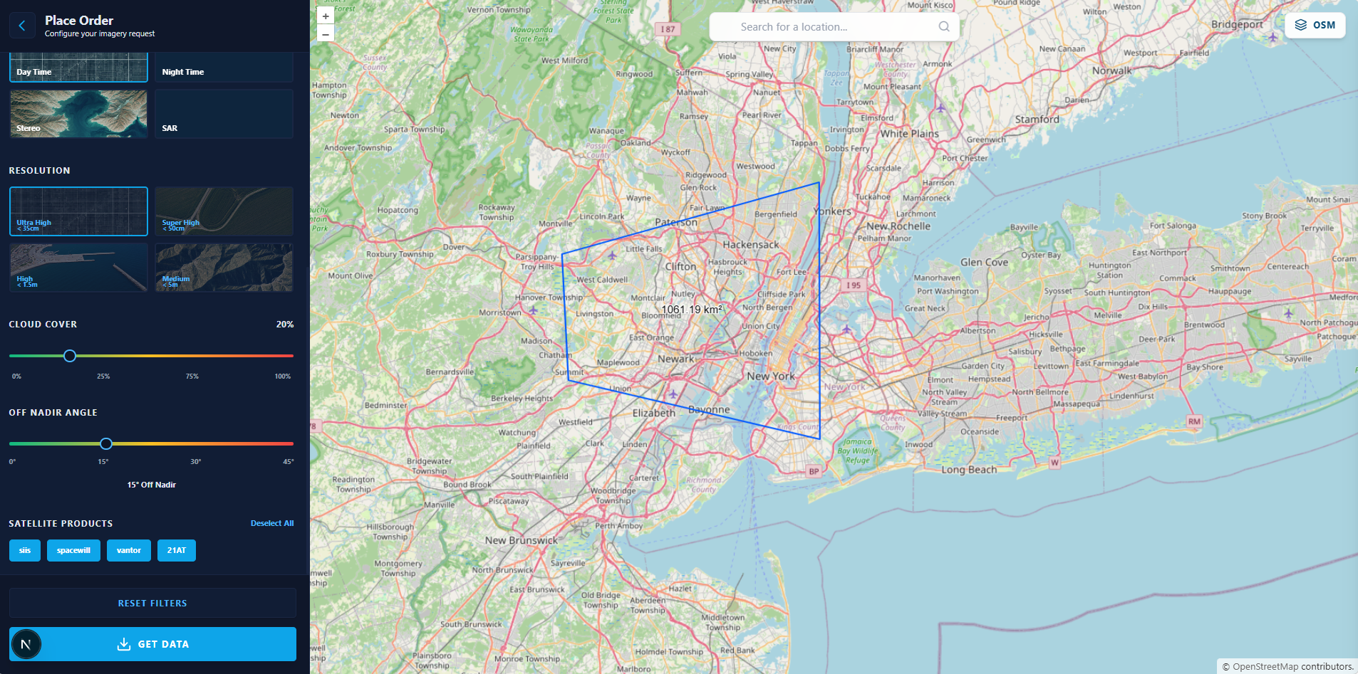
Define Your Area of Interest
Draw polygons, rectangles, or search locations on our interactive map. Get real-time area calculations and preview available scenes.
- Polygon & rectangle drawing tools
- GeoJSON import for batch AOIs
- Live area calculation (sq km/acres)
- Save locations for future requests
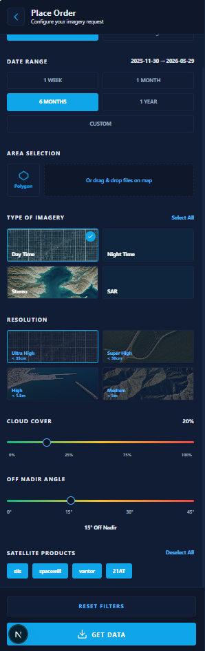
Select Your Specifications
Choose your satellite partner, imagery type, resolution, and acquisition parameters. Filter by cloud cover, date range, and sensor type.
- 5+ satellite partners
- Optical · SAR · Hyperspectral · Elevation
- Archive (instant) or Tasking (future)
- Resolution from 0.3m to 30m
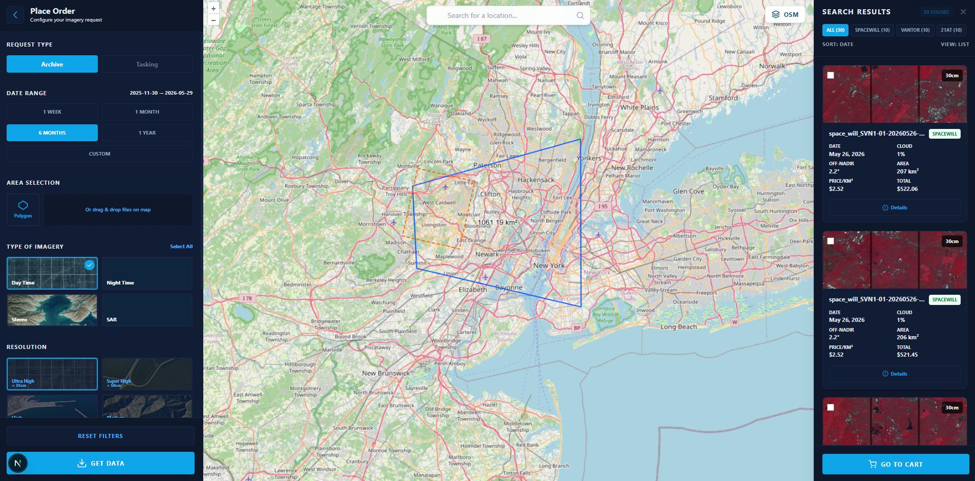
Review Available Imagery
Inspect the satellite imagery returned for your selected area, compare available scenes, verify quality metrics, and review pricing before proceeding.
- Available imagery from multiple satellite providers
- Acquisition date, cloud cover, and resolution details
- Real-time price estimation
- Coverage and specification validation
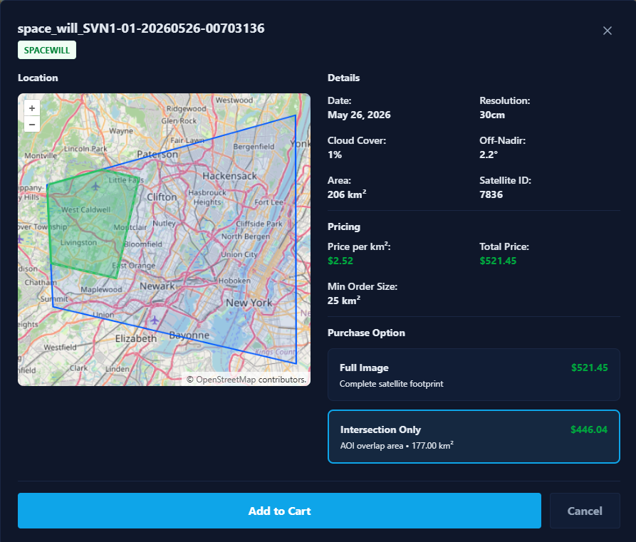
Submit Your Request
Select your preferred imagery coverage, review the final pricing and specifications, then add the imagery to your cart and submit your request.
- AOI Intersection or Full Scene selection
- Coverage and pricing review before submission
- Specification validation
- Add to cart and submit
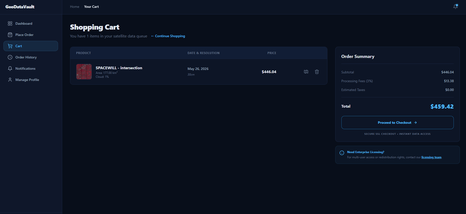
Track Your Order Status
Monitor request status in real-time through your dashboard. Get notifications at every stage of processing.
- Real-time status updates
- Validate pricing and fees
- Review cart items and specifications
- Proceed to checkout
- Receive confirmation and tracking
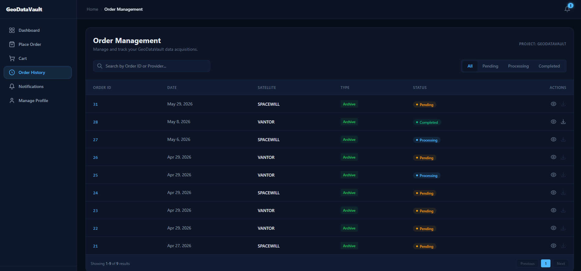
Track & Download Data
Monitor your imagery requests, track processing status, and access delivered data from a single dashboard.
- Track order status
- View order details
- Download completed deliveries
- Access order history
- Receive status updates
Technical Capabilities
Enterprise-grade features built for mission-critical workflows.
Imagery Types
Optical
Panchromatic, Multispectral, Pan-sharpened
SAR
X-band, C-band, L-band
Hyperspectral
200+ spectral bands
Elevation
DEM, DSM, DTM, Stereo
Acquisition
Archive
Historical catalog, immediate availability
Tasking
Future capture, commission satellites
Specifications
Resolution Range
0.3m – 30m
Cloud Cover Filter
0-100%, recommended ≤20%
Max AOI Size
10,000 km²
Formats
GeoTIFF, JP2, COG
Tasking Lead Time
3-14 days typical